
Home address: S.Konarskio 28A, 03126, Vilnius, Lithuania
Phone/fax: +370 521 50575
E-mail: info@hnit-baltic.lt
Website: www.gisbaltic.eu,
Defense industry page: https://www.gisbaltic.eu/en-gb/arcgis-defence
General information about the company: Hnit-Baltic group, consisting of Hnit-Baltic UAB (Lithuania), Envirotech SIA (Latvia) and AlphaGIS OÜ (Estonia), serves public and private customers in the Baltic States by implementing geospatial analytics, location intelligence, mapping, and other IT solutions powered by Esri ArcGIS – modern GIS (Geographic Information Systems) technology.
Hnit-Baltic is the official distributor of Esri, the global market leader in GIS. The group offers a geographic approach to problem solving, adjusts and customizes GIS software products according to customer demands and workflows, develops industry-oriented applications and spatial datasets, assures user support, provide consultation and training, helps customers integrating spatial and non-spatial data and systems.
The GIS products are applied in a wide variety of industries & activities like mapping, business analysis, asset management in state and local government, public security, national defense, utilities and other infrastructure companies, AEC (Architecture, Engineering & Construction), transportation, forestry, telecommunications, natural resources, etc.
We providing everything needed for GIS implementation:
- Esri offered solutions – ArcGIS software, providing a solution tailored to your needs (including cloud-based, on-premises or hybrid infrastructure) and variety of applications;
- Consultancy, training, and technical support for existing customers;
- GIS concept development, customization, implementation, maintenance;
- A wide range of spatial data processing, analysis, visualization, and sharing;
- Development of customized GIS software solutions and tools and other GIS-related services;
Software and process will be demonstrated:
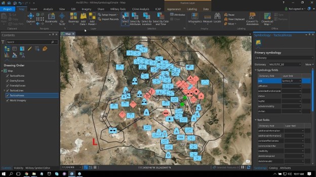
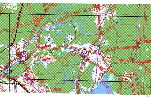
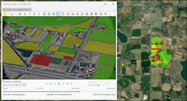
Defense organizations are challenged to take quick and decisive action based on data from numerous systems, sensors, and sources. Using geographic information system (GIS)-based solutions, all types of operators and decision-makers can
– Aggregate and integrate many types of data
-Model, analyze, and visualize all aspects of the operational environment
-Deliver user-driven applications that harmonize efforts across domains, functions, and echelons
-Enable situational understanding and collaboration across the enterprise
We will demonstrate how defense and intelligence organizations can integrate GIS technologies to manage processes, workflows and communications. With GIS everyone can integrate diverse types of data to derive understanding, operationalize solutions, share insights, and engage stakeholders and the public.
You will see how using GIS everyone can incorporate location intelligence into high-level decision-making that provides powerful insights on critical issues and supports science- and analysis-based situational awareness.

Picture4
Picture1
Picture2